Blog Summary

Dan Seng's journal of his travels as the 2011 University of Illinois Francis J. Plym Travelling Fellow

Friday, October 28, 2011

BIKE COMMUTER HAVEN

BARCELONA UPDATE - OCTOBER '11
The biking stations that I saw in London last July were just the start of my exposure to this type of bike share program. Gothenburg, Oslo, Paris, the Ruhr Valley and Seville have all implemented some level of bike sharing throughout the city. None have implemented it with quite the same success as has Barcelona. Within a matter of 4-5 years, Barcelona has added 80 miles of bike lanes and through the Bicing program has put 6,000 rental bikes on the streets. The good weather and relatively flat streets were a good start at making the city conducive to increasing bike ridership. After a couple minor bumps in the road, the city has managed to continually increase the number of bikes to the point today where they have become a popular mainstay of the locals. 
Here is how the system works. Member fees, parking fees, city subsidies and advertising revenue together fund this $13 million a year program. Riders pay an annual fee to get a magnetic smart card. They are charged 30 euros a year for the membership, then each time they rent a bike it's 30 cents for every half hour (the first half hour is always free). Given the number of stations available (375 according to this article) that makes the cost pretty reasonable for the average user. Costs are spread out with the city taking the lion's share. Getting more bikes on the road is happening through some creative avenues. Thankfully, it doesn't require that we all buy $1,500 bikes and wear spandex


AMSTERDAM UPDATE - SEPT '11


As expected, Amsterdam was the penultimate bicycle Mecca. The temple is the bike storage shed by VMX Architects in front of Central Station that reportedly houses some 7,000 bikes! There are bike paths to all parts of the city. Trains allow bikes on board, trams and buses do not. The bus and tram are served by islands in the middle of the road. Passengers cross the bike path to board.


Of particular interest was the abundant use of motorized scooters on the bike path. These obey the same traffic laws as bikes, but move much quicker. Some electric scooters are so quiet that they sneak up on you before you have time to turn your head. The other amusing vehicle on the bike path is the electric mini car. Smaller than a golf cart and fully enclosed, the drivers behind these chariots I saw were in the senior age bracket. 

As you can imagine these paths get quite crowded. There is an understanding and respect on the road for all means of transport. Trams and buses know to look for bikes and pedestrians. Bikers respect traffic signals and the cars are seemingly a non-entity. This symphony of movement on a busy city corner can be remarkable to watch.

COPENHAGEN has it worked out on a totally different plane. BIKES=CARS. They have their own lanes, separate from pedestrians and vehicles. Bus stops are typically on islands between the bike lane and the car lane. Bikes, have street lights, turn arrows and these nifty rails on stairways to bridges and overpasses (when they don't have a devoted ramp).


Bikes are parked everywhere. The city can't keep up with the demand, but its not as if there is parking for cars and not bikes. I have seen one parking structure and literally thousands of bike racks.


The trains devote half of a car to bikes, strollers and wheelchairs. The car and the pavement on the platform are clearly marked. One or two residents saw fit to clearly mark this car for their own purposes.


I took a ride into Copenhagen city center this morning. The ride was safe. Drivers watched for bikers and there was little confusion as to where the bike lanes were routed. A susbstantial construction project is underway on the Town Hall Plaza (Radhus Pladsen). The bike lane is maintained right through the middle of the site and roped off as it emerges on to the street. 

This is a model worth replicating.


LONDON 
With bike lanes on the busiest roads and full width bike lanes at the thorny intersections, bikes aren’t exactly ruling the road, but they have a place in London.

Barclays has teamed with the Mayor of London and is building brand new "cycle superhighways". They have implemented a bikes for hire program that is catching on in the Westminster and surrounding burroughs. I was  staying outside the zone and usually had two kids in tow, so couldn't make much use of them. I did see their bikes on Clapham, right down the street from our flat.


The bikes are locked in their rack, you pay a pound to rent them for 1/2 hr. The rate goes up quickly after that with steep fines for late drop-off. They are designed to be ridden from point A to B and their are enough of these kiosks around that the scheme makes sense for certain trips.


Check out their fun video at this site:


Monday, October 24, 2011

le GRAND LARGE DISTRICT - DUNKIRK FRANCE


Stephane Chalmeau
In the ultimate feat of redundant naming, the City of Dunkirk branded the master plan of their abandoned waterfront to make certain it was clear to everyone the tremendous size of this development. But in this case, it's not size that matters. The name in French refers to the open sea that this master plan turns to address.
The City of Dunkirk, the Port Authority, Projénor (a developer) and the Town Planning Agency entrusted the master planning of their industrial waterfront to Richard Rogers. In 1991, the city council approved the plan and called it the Neptune project. The focus of the planning was to orient the city toward the water and to urbanize the brownfield remnants of Dunkirk's industrial past. The first phase was to renovate the city squares, construct the new University and promote new commercial development. The goal of the second phase was to build "quartier 21" to meet the sustainability goals of Agenda 21. The Grand Large District is the 42 hectare 2nd phase of the master planning effort. It is located northeast of the city center on the site of a shipyard left vacant when the shipping company closed its doors in 1988. Work began in 2005 when the selection committee awarded the project to the French architecture firm Nicolas Michelin (ANMA).

ANMA Master Plan Concept
The location on the waterfront and only a short walk from the city center made it ideal for residential development. This was an underlying point of the Neptune project; to stem the tide of deurbanization sweeping the city due to rising property costs and fewer inner city jobs.
To attain the sustainability goals, the buildings harness the power of the sun, rain and the trash. The attached single family homes have roof mounted photo-voltaic cells. Units are well insulated, use mechanically assisted natural ventilation and are kept warm with district heat recovered from a local waste incineration plant. Rainwater is harvested from the urban park and the gable roofs.
In addition to the environmental aspects, the development is promoted as a cultural, recreational and leisure hub for Dunkirk. It makes this point by drawing attention to several components of the plan; a community center/ gymnasium, an urban park area, access to the public beach and access to the contemporary art museum LAAC (Lieu d'Art et d'Action Contemporaine). The social emphasis on the development is supported by the fact that 40% of the units are set aside for social housing and 10% for first time buyers.
The shimmering metallic gable roofs of the waterfront buildings combined with the warm color of the wood cladding give the development great curb appeal. It was the cover image that first turned my head toward the activity in this port.
Observing the district first hand reinforced this first impression. The depth of forethought with which ANMA approached the planning has paid off. The contemporary park design, inclusion of the cultural and recreation programs, the pedestrian scale of the development and the playful use of form and material on the buildings all lend Grand Large a strong sense of livability.
The distinct lack of privacy screening on either the waterfront gable buildings or the inner attached single family homes, on the other hand, illustrate a priority on planning and design over residents needs. The maturing landscape (where planted) will help address this concern within a couple years. Residents of these first 216 units, of the planned 930, will have to wait for other elements to grow in as well. Things like public transportation and a grocery store. The Department of Geography at l'Ecole normale superieure has acknowledged the tangible disconnect between the city center and the Grand Large district and lack of a center of activity. Their remedy? Activate the old port area (Citadel) by building up a new center around the University buildings. This solution fails to take advantage of existing attributes of the city and is divergent from the original master plan. The addition of commercial and retail space to the development would provide the necessary day and nigh activity to the community. 
The current lack of commercial or retail space lends it an eerie-ghost-town sense after dark. The projects ultimate aim is a total of 1,500 units and 40,000 m2 of retail. This density will be the seed that private investment will fertilize to fill out this growing community. Only then will this community have earned its name.


Saturday, October 22, 2011

EMSCHER PARK - RUHR VALLEY GERMANY

Rid your mind of Emscher Park as a "park" in the traditional sense of the word. How can 800 square kilometers of industrial land bound by two shallow rivers ever be considered one single park? It was this mental barrier that perpetuated my complete ignorance of the development concept well into my stay in Essen. Online, I could find information regarding Zolverein, Landschafts Park and the Oberhausen Gasometer, but they were all in different areas of the Ruhr. So, I kept asking myself, so where is "Emscher Park"? The Ruhr is the park. A 1999 article in Architectural Review called the area
"...one enormous tract of developed land: a dense fabric of coal mines and steel works, factories blending into housing and small commercial centres, criss-crossed by autobahns, railways and sewage channels..."

In reality the Emscher river is the spine to a serpentine network of industrial areas rejuvenated by beautiful landscaping, dozens of bridge crossings and adaptative reuse of bold, functionalist, industrial structures of the area's coal mining legacy.

The area bound by the Ruhr river to the south and the Emscher river to the north is referred to as "The Ruhr". The rivers converge at the Rhine on the eastern boundary of the area in Duisburg. A cluster of 17 different municipalities (Duisburg, Oberhausen, Mulheim, Essen, Bochum, Gelsenkirchen and others) are networked by a common public transportation and local rail system. It has the infrastructure to operate like a large metropolis of these smaller cities. The seed that gave birth to this once great industrial region lies in the abandoned coal mines 2 kilometers below the surface. Industrial decline of the late 20th century affected the Ruhr area in a serious way leaving social and environmental scars. In 1989 the development association IBA Emscher Park was formed with the directive of revitalizing the region focusing on restoration of existing buildings and the contaminated water and land in the area. The resulting list of development projects under the IBA comprises what is now marketed as "Emscher Park".
View of the Emscher from the roof of the Gasometer
The IBA expired in 1999 and a successor plan called "Project Ruhr" took over development with a focus on cleaning up the Emscher River and changing the public perception of the area. The projects are categorized as cultural, outdoor or entertainment hot spots along the river. The project culminated in the 2010 EU designation of Essen as the "European Capital of Culture." This status launched a year long calendar of events drawing attention to the culture and activity within the area now housed in restored industrial buildings. The projects have become tourist attractions broadcast over this vast area like a virtual amusement park. Five visitor centers serve as gateways to a park themed not on cartoon characters or Legos, but the region's rich industrial heritage.
Zollverein
If you visit the area and have time to see only one site, make it Zollverein. You should not miss the acres of jaw dropping mega-structures playfully incorporating museums, shops, offices, artists studios, restaurants and a swimming pool. Guided tours are offered through the mining operations by the men who used to work them. The structures designed by the architects Fritz Schupp and Martin Kremmer were built between 1928 and 1932. There are twenty buildings on the site, some of them completely empty. These beautifully designed buildings are the true museum pieces that helped Zollverein earn an UNESCO World Heritage Site designation.
This is a functioning Ferris wheel! It gives visitors a view inside the coking plant, giant ovens that baked the moisture out of the coal after it had been washed. The structure is over 600 feet long.
The rail lines that stitch buildings together have been converted to a delicately landscaped cluster of walking paths and sculptures. You can spend hours there and not see the entire site. I couldn't possibly take pictures of all of it, but I did post more in the online album. New buildings on the site take cues from the simple forms. The recently completed Zollverein School of Management building by Kazuyo Sejima + Ryue Nishizawa / SANAA is a giant cube perforated by square openings. It is a perfect fit on this site.
Gasometer, Oberhausen
Steps from the tram stop, I walked into the Ruhr visitor center in Oberhausen where I navigated their cool interactive digital map and located myself in the center of a new retail/commercial district opposite the Stadium and only 500 meters from the entrance to the Gasometer. I bought my ticket to the Magic Places exhibit and made the short trek to the front door. Standing inside this 60 meter diameter, 117 meters high structure has a peculiar disorienting affect.
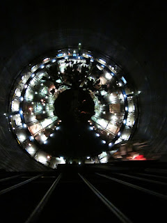
Couple that with cinematic lighting and it's hard to not feel like an extra on the set of a "Close Encounters" sequel. The tree sculpture at the center in this image is 40 meters high. The elevator climb to the top inspires vertigo about the time you reach the tree top, and I still had 77 meters to go!
view of the tree canopy and exhibit below
Permanent mural photo exhibit of Oberhausen in its industrial heyday
Inside the lower two levels of the Gasometer house a cafe and rotating exhibits.
Nordstern Park
This park is aligned along the canals of the Emscher River that were the conduit for the materials going in and coming out of the Nordstern Coal Mine. Tours of the coal mines, an entertainment venue and playgrounds are focused on bringing families out to play in the yards surrounding the shells of a bygone industrial era.
The Nordstern coke plant has been converted to an office building and sits amid other office buildings and a parking structure as the corner stone of an office park.

The breadth of each development project is almost too much for one person to digest in a day, much less the entire length of all Emscher Park. They are connected by a regional bike and hike trail and are also part of an Industrial Heritage Cultural tour. To see them all would take serious devotion and time. One park that I didn't get a chance to visit that appears to be an equally spectacular place is Landschafts Park in Duisburg, designed by the German landscape architects Latz + Partners. The 50 acres of defunct steel refinery have been turned into an all ages playground. Rock climbers scramble up the battered concrete walls, tourists walk hundreds of meters of elevated catwalks and here, scuba divers (not art) fill the gasometer structure. There's something for everyone in Landschafts Park.
Leaders in Germany considered difficult options for the Ruhr's future. Compare the results today to the alternative of planning, demolishing and building new structures and the wisdom of their choices is clear. Twenty years after it's start, the area has embraced their industrial past and replaced the contaminated soils and unemployment lines with a growing tourism industry, hundreds of acres of recreational area and a host of cultural upgrades.

Thanks to sustainablecities.dk for providing sources and reference information about the area.

Tuesday, October 18, 2011

MALMÖ REGION

The Western Harbor development has earned a reputation as a tourist destination. Its monument, the Turning Torso, can be seen for miles around and draws visitors like bugs to a lamp on a summer night. This is for good reason. The tower is a structure of sculptural beauty and Western Harbor set the standard for mixed use development in the 21st century. Rarely, however, do you hear of future plans in Malmö. The city is growing rapidly and the bar for environmental standards is set high. The City has targeted 2020 for all public buildings to operate on 100% renewable energy sources. By 2030, the entire city will run on hydro, solar, bio-gas and wind power. This goal outpaces Stockholm's targets by two decades.
It appears that the City Administration has successfully changed course from a city focused on shipping and industry to one supported by tourism, education and technological expertise. But there is still work ahead of them. The Western Harbor area suffers from limited transportation connections to the city center and a city core that is active day and night throughout the year. Projects in Hyllie, Augustenborg and further development in the Western Harbor aim to strengthen these connections, to build on the momentum from Western Harbor's success (both financially and environmentally) and to preserve the city's status as a leader in sustainable development.
Siemens press picture of  the Øresund bridge and wind farm 
Following the opening of the Øresund Bridge in 2000 the city experienced significant growth. Then, the population of Malmö was 250,000 people. Today it is 300,000 (20% growth in 10 years). By 2050 population is projected to climb to 400,000. The tunnel connecting the bridge to Central Station opened at the end of 2010. There is now a connection between Copenhagen airport and Malmö Central Station that takes 18 minutes to traverse. These improvements will ensure a steady influx of tourist, business and commercial traffic - not to mention significant population migration.


This video authored by the Copenhagen firm BIG is focused on development potential around Copenhagen but it spells out a plan for the entire Øresund region that the bridge connection made possible. Jump to 5:45 to see how this region is envisioned as a centerless city by stringing together the region with power, water, waste and transportation infrastructure.
Copenhagen aims to infill their urban environment with new development, but with the bridge in place, Malmö is physically closer to its center than its nearest suburbs and there is room to grow. The first stop on the train once visitors cross the bridge is the Hyllie station. It is here that the City of Malmö has plans to build a major new development.

City of Malmo promotional video
HYLLIE
A new transit oriented development of 8,000 residential units and 8,000 offices is planned for this greenfield site south of Malmö at the Hyllie station. A convention center and arena opened in 2008 kicking off the development activities. The Emporia shopping center designed by Wingårdhs Architects is under construction and completion is anticipated some time next year.
Wingardhs

Photo credit
AUGUSTENBORG
To a large extent, and from a new construction sustainability perspective, the design and construction industry in Sweden is self-sufficient. It requires less incentive and stimulus from the city than it has in years prior. Recently, international attention has turned to the challenge of energy upgrades to existing buildings. Here again, Malmö has taken a proactive response to this challenge.
Green roof, PVs and rain gardens at Augustenborg municipal building
In the early '50's, Augustenborg was a contemporary development that attracted local professionals and their families. Larger apartments in the city center or stand alone homes in the suburbs drew the tenants from the development in the '60's. By the early '90's the area was known more for its high rates of crime, vandalism and drug use. In 1998, the City designated Augustenborg as 'Ekostaden' or 'Eco-City' and used the existing 1,800 unit, post war development as a test bed for sustainability upgrades.
stormwater overflow area
The idea started as a discussion between individuals at three organizations, the Department for Internal Services, MKB (Malmö's public housing company) and the Augustenborg school. They managed to stimulate interest in the idea of Augustenborg as a sustainable development. The open channel storm drainage system and the green roof experimentation on municipal buildings were designed to address recurrent flooding problems on the site. But the entire development was planned to be socially, economically and environmentally successful. Community members were invited to join workshops and provide ideas to improve their community. The resulting development serves the needs of its residents, addresses the demands of the changing weather conditions and is fully occupied. For this, the development earned a UN world Habitat Award in 2010. The facade upgrades are on hold pending further funding. The design, community involvement process and the upgraded buildings themselves serve as examples for planners, designers and builders faced with questions surrounding the sustainability upgrades to existing buildings.
Masthusen Master Plan - Kanozi Architects
WESTERN HARBOR - NEXT STEPS
The trip to the Western Harbor requires a bus ride or a 20 minute walk from Central Station. The public transportation, or lack thereof, does stand in the way of the potential for this area. But the 3,000 residents in the Bo01 development alone are not enough to justify the expenditures for a tram, subway extension or more frequent buses. The University and new businesses are cropping up in all corners. And more residential mixed-use development is either in planning or under construction.
City of Malmö - Western Harbor Master Plan
The Masthusen area places an additional 1,000 units of housing, offices, educational buildings and retail on the site southeast of the turning torso tower and just south of the planned central park. The mixed use aspect of the proposed master plan will help to infuse the area with off season daytime activities and some much needed night life. The Fullriggaren block, primarily offices and residential buildings is currently under construction. It, together with the Kappseglaren area will add another 1,000 units.
And this is just a sampling of the activity on this peninsula of land. There are too many to mention all of them here but they are available on the city Western Harbor site. Based on the master plan below, which shows unit counts by block, at full build-out the Western Harbor will have more than 10,000 housing units. Combine that housing with the new university and numerous business moving into the area and you have a small city within the city built at a comparable density and following the strict environmental standards established for the Bo01 project.
Housing plan diagram from City of Malmö

Sunday, October 16, 2011

HAMMARBY SJOSTAD

The Hammarby Sjostad area, south of city center, was conceived in the early 90's as an Olympic Village for Stockholm’s bid for the 2004 Olympics. Stockholm staked their bid on a highly sustainable Olympics. They of course lost the bid to Athens. But watching the London 2012 Olympics planning unfold, they were clearly ahead of their time. Despite losing to the Greeks, Stockholm moved forward and invested heavily in the development to make it a test bed of new sustainable building system technologies. Now nearing complete build out, the development is one of the foremost research destinations in the world for developers, city planners and architects. 
Aerial from City of Stockholm
The environmental goals for the project were set in 1997, late in the design process.

  • 75% built in public transportation at the start 
  • 80% target for commute to work by means other than a car (actual is 79%)
  • Be twice as green as other developments. In other words, lower the environmental impact by 50% (actual is 30-40%)
  • Provide means for residents to work on site (8% actual is lower than expected).
Map from City of Stockholm (hammarbysjostad.se)
The master plan provided for 11,500 residences and 10,000 offices (28,000 people) on 204 total hectares, 171 of them on land. Construction started in 1997 and is nearly complete. The total cost to date  is 4.5 billion euros. Currently there are 20,000 people living on site. The development is quite popular among young families. So, of the total population, 15% are children under 16 years - a much higher percentage than expected or planned. Original plans called for 1 school and 1 daycare center. There are now 3 schools and 15 daycare facilities throughout the area.

The city leased or sold the land to numerous developer/design teams and built the project in phases. Public transportation was key to the success of the development. The car trips, parking and city access were part of the planning discussion from the outset. Currently there are 0.7 parking spaces per unit and nearly 80% of the residents commute to work by some means other than a personal car.

The technology in Hammarby Sjostad was, in many instances, so new that the systems have not been broadly copied. Only now is the city collecting the data on system performance to make it available for use on other projects. The data will be a valuable tool for Stockholm as they embark on the next major development at the Royal Seaport project. Preliminary reports are available on the project web site. It will also serve to refute or validate numerous energy savings, water savings and urban planning strategies for the building design and construction industry at large. As part of the Royal Seaport project, the city has mandated that the information be collected real time and shared within the city and abroad to further advance the public knowledge of sustainable technologies. 
As an ongoing educational resource, the project planned for an informational showroom for residents and visitors called GlasshusEtt. Its dual-glazed facade, solar cells and fin-tube heaters running on district heat from a bio-gas boiler make it an extremely energy efficient building by any standard. Through surveys, community outreach programs and seminars, the staff here have helped reduce water usage on site and impacted significant change in behavior within the development.


Below is a partial list of the sustainable solutions incorporated on site.
Water
  •         Wastewater treatment plant that creates biogas for stove gas and city buses
  •        Stormwater collection and on site treatment
  •     Bio-deegraded sewer sludge is used as fertilizer and to make bio-gas
Fortum Energy's thermal power plant
Energy
  •        PV panels on the roof of select residential buildings to produce power for common areas.
  •        Solar tubes for hot water heating on select buildings
  •         District heating and cooling from treated waste water
  •      Bio-gas made as a bi-product of waste water treatment used as bus fuel
  •      Bio-gas used for district heating
Waste
  •         Below grade vacuum waste collection service for residential buildings
  •      Waste is sorted for recycling into 4 fractions
  •      Bio-degradable waste is composted and used as fertilizer or turned into bio-gas
  •      Combustible waste is incinerated and used for district heating
Transportation
  •         Bus and tram connection to local train station
  •         Car share program
  •         Minimal parking per unit
  •         Bike and pedestrian friendly road system
  •         Free ferry shuttle across bay every 15 minutes
  •         Public access marina
  •         Live/work development concept
Locks and salmon ladder
Ecology
  •         Land bridges over freeway connect nature reserve to site
  •         Reed bed in bay and along canal edges encourages bird habitat
  •         Salmon ladder on locks
view to school and residences from nature reserve
Social and public health
  •         Pocket parks, access to public nature reserve and ski area
  •         Bridges, paths and bike storage promote walking and biking
  •         3 schools and 15 daycare buildings on site